
Guayana Esequiba: Why Venezuela Claims the Territory West of the Essequibo
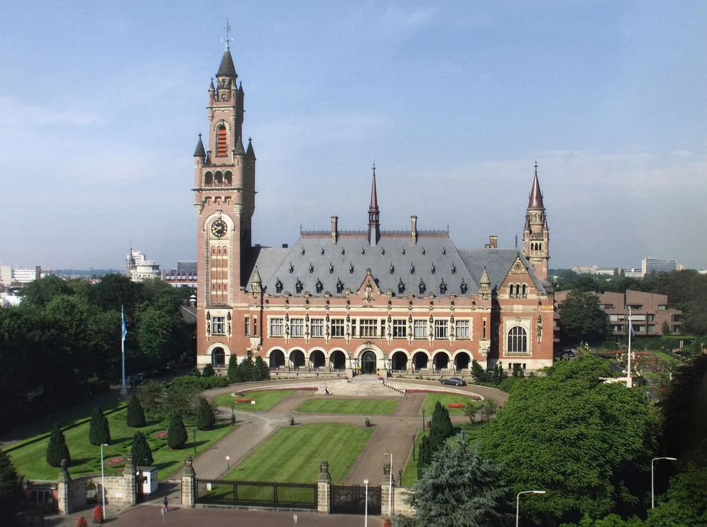
The International Court of Justice case record lists public hearings on the merits held from 4 to 11 May 2026 and its earlier provisional-measures orders. This is the primary record for procedural developments; the present guide does not predict the outcome. For the current procedural record, see the ICJ case page.

What is Guayana Esequiba?
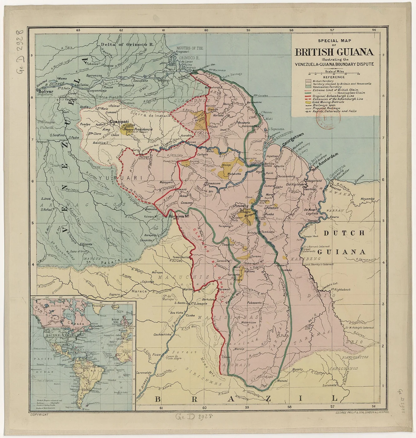
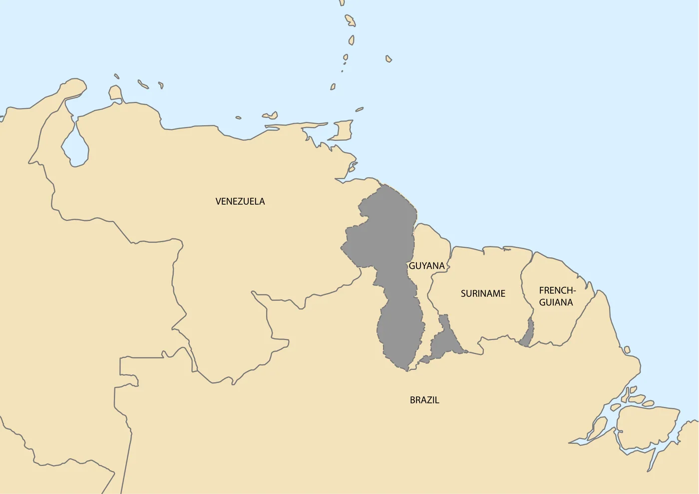
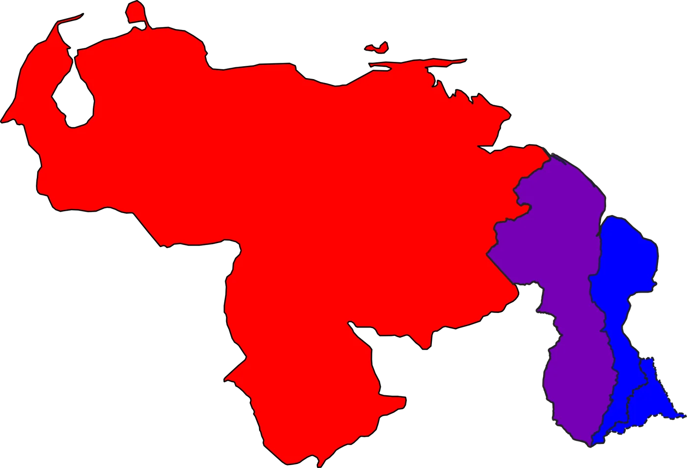
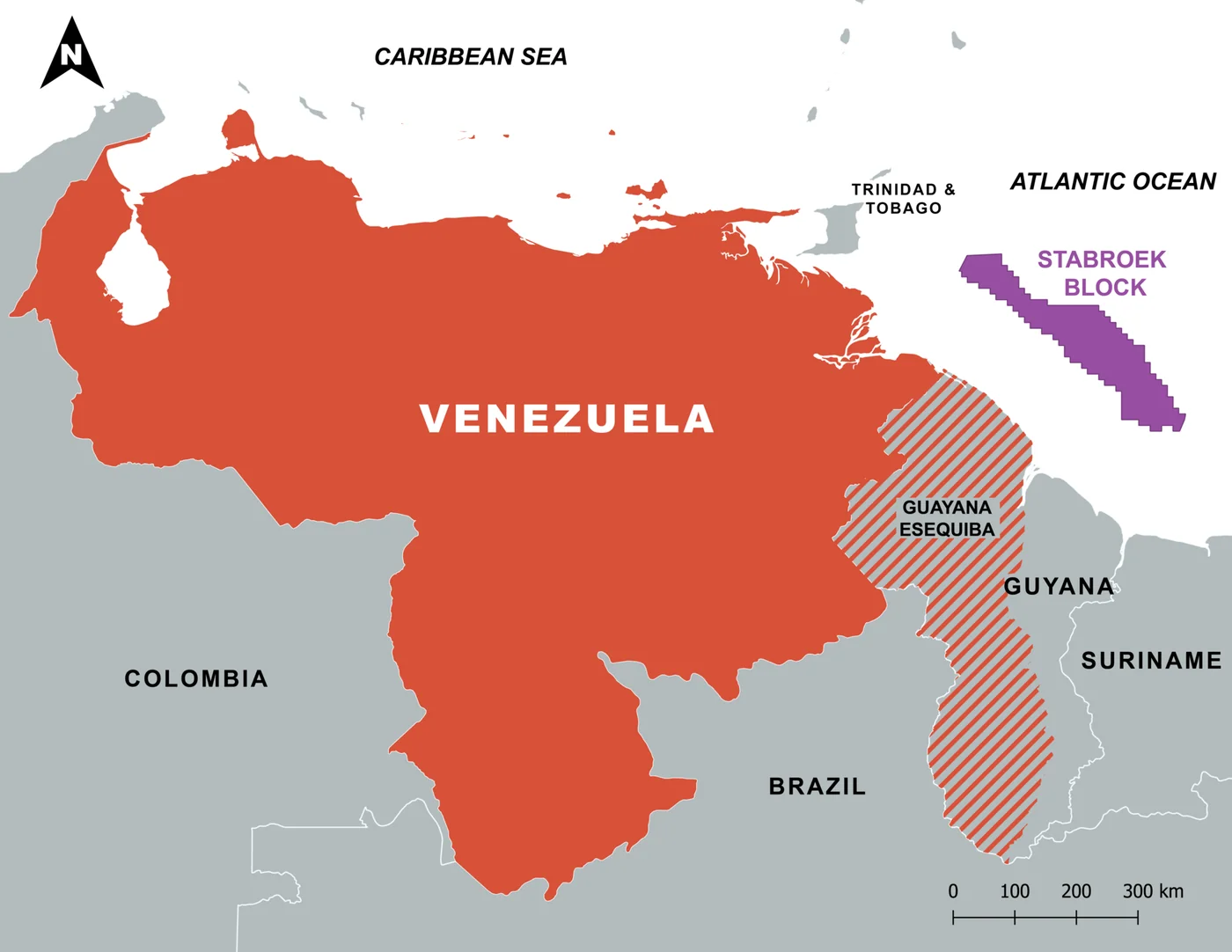
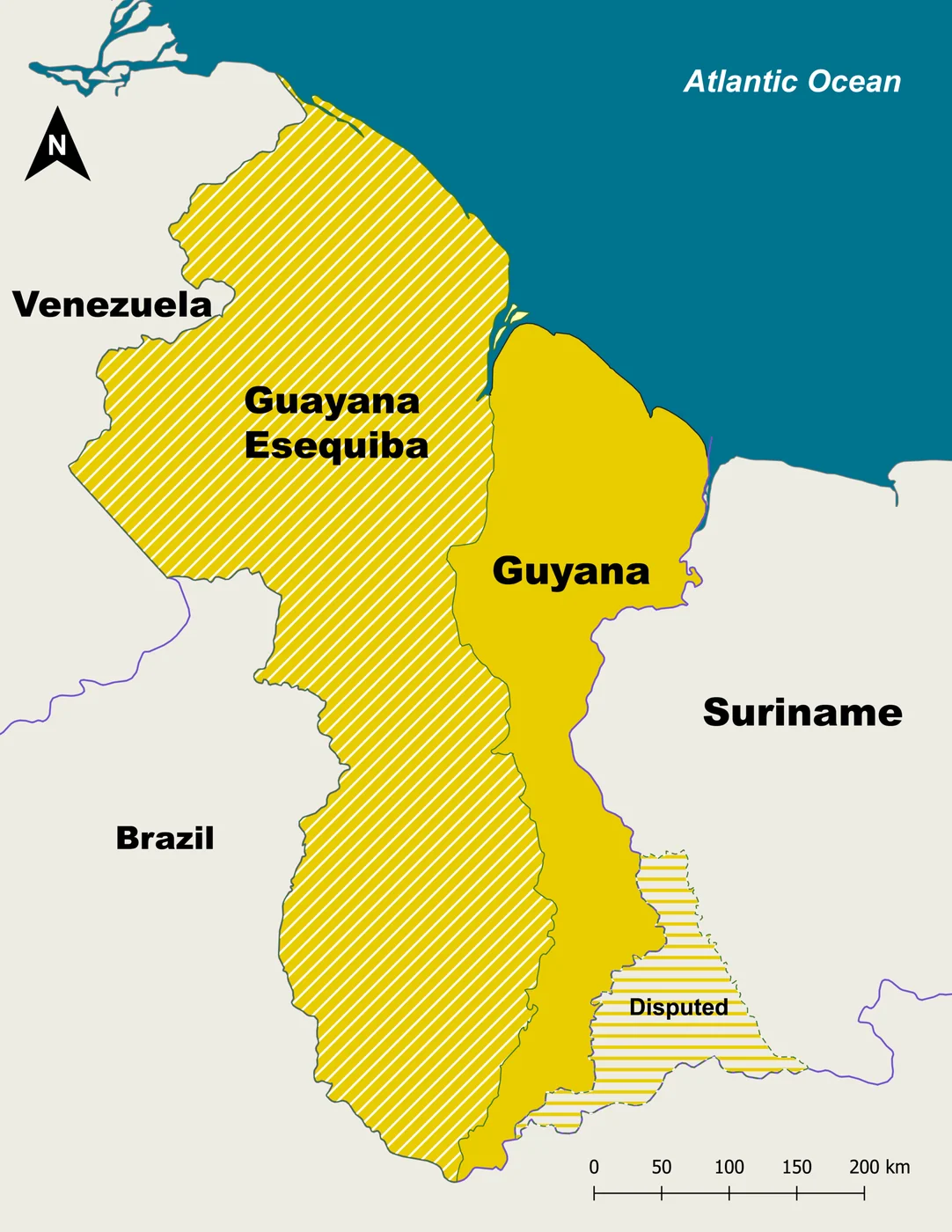
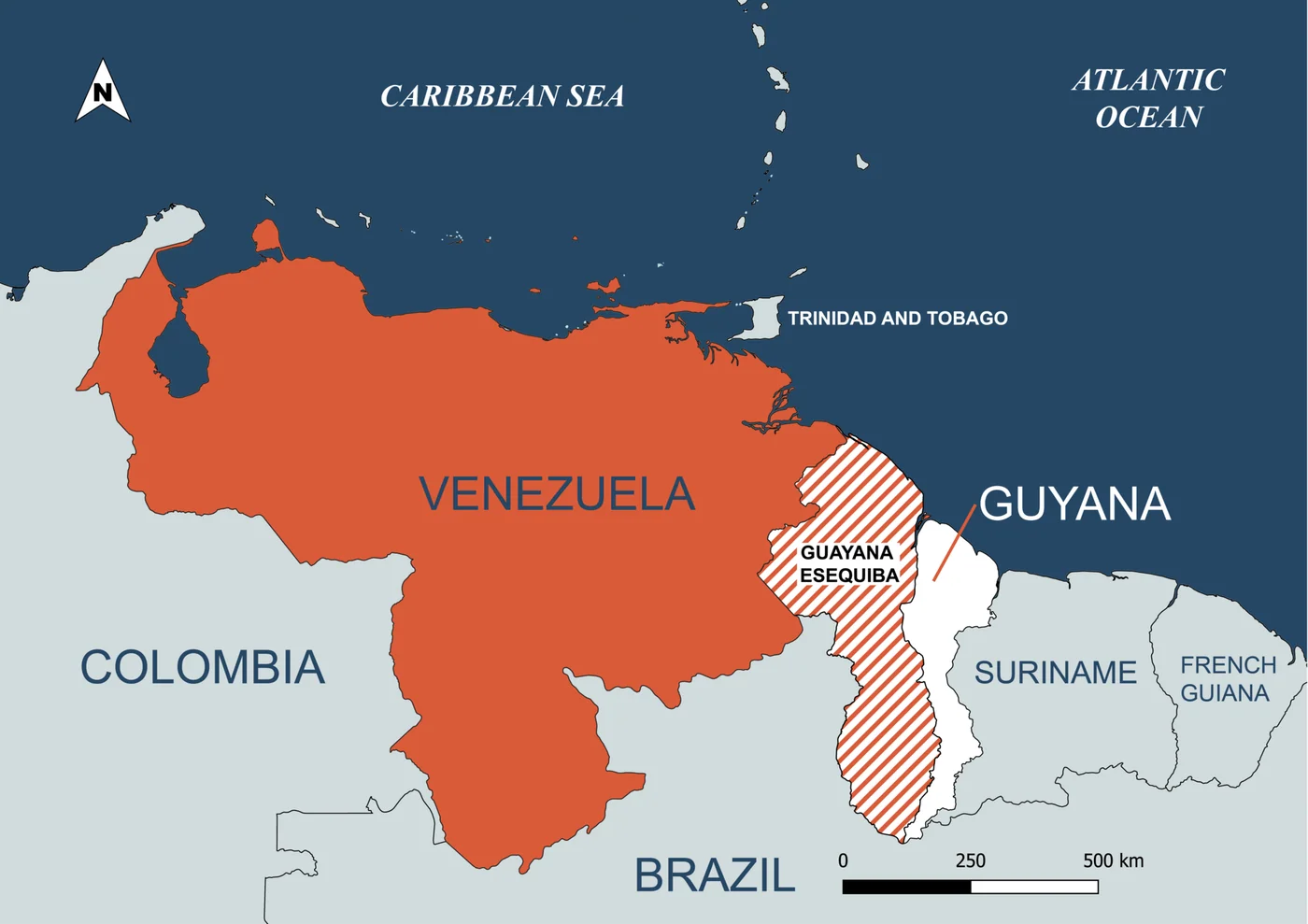
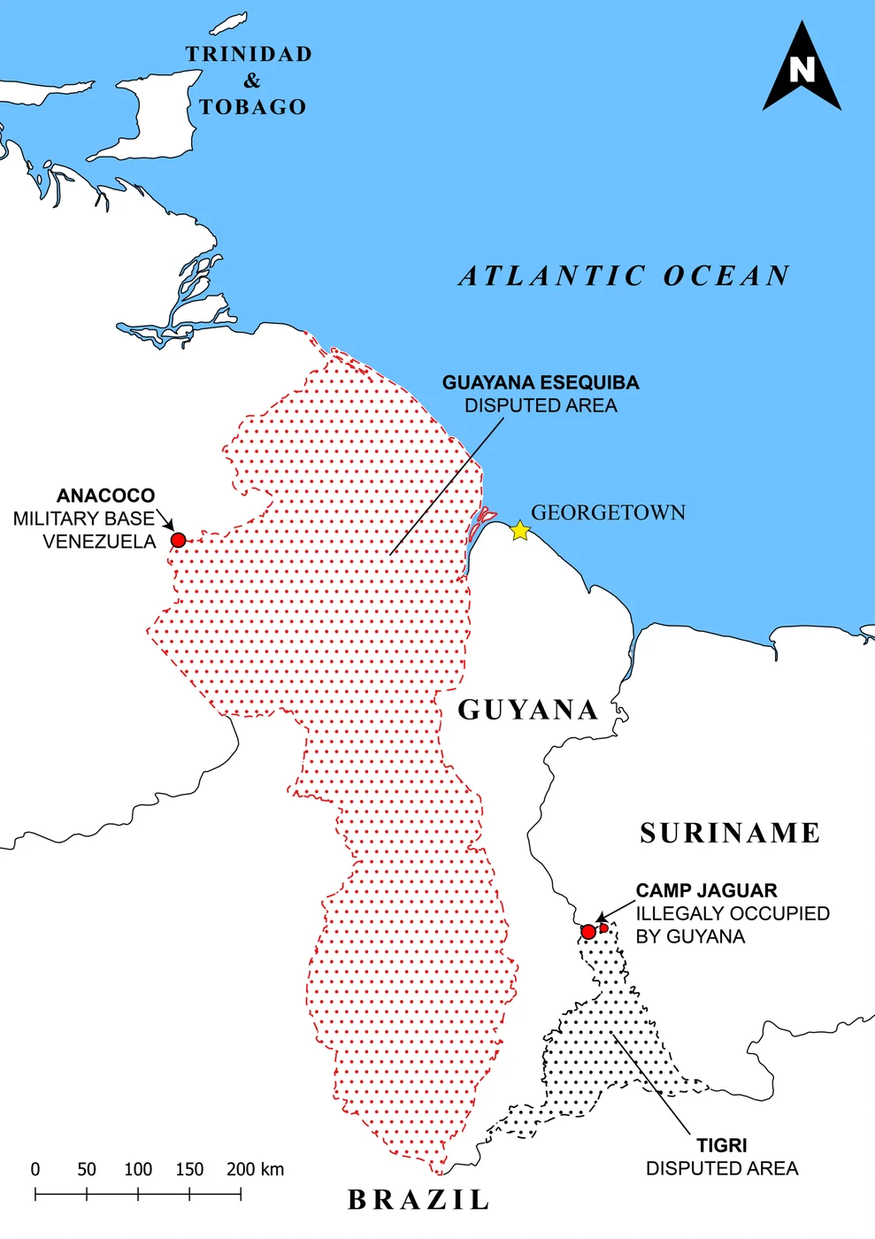
Guayana Esequiba is the name Venezuela uses for the territory between the Essequibo River and Venezuela’s current eastern administrative line — roughly 159,000 square kilometers. That area corresponds to a large portion (often described as about two-thirds to three-quarters) of the land Guyana administers as its territory west of the Essequibo. Maps in Venezuelan schools and official discourse have long shaded this zone as claimed. Guyana calls the same space an integral part of its sovereign territory under the 1899 Award and subsequent administration. The Law Library of Congress overview gives a comparable legal and geographic summary.
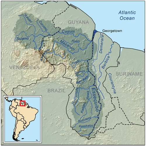

For foreign readers, the practical point is simple: this is not a minor border strip. It is a region with forests, minerals, potential hydrocarbon zones offshore, and a live international legal process. Understanding the claim helps interpret Venezuelan politics, regional risk, and why maps differ depending on which country’s atlas you open.

Colonial titles and uti possidetis
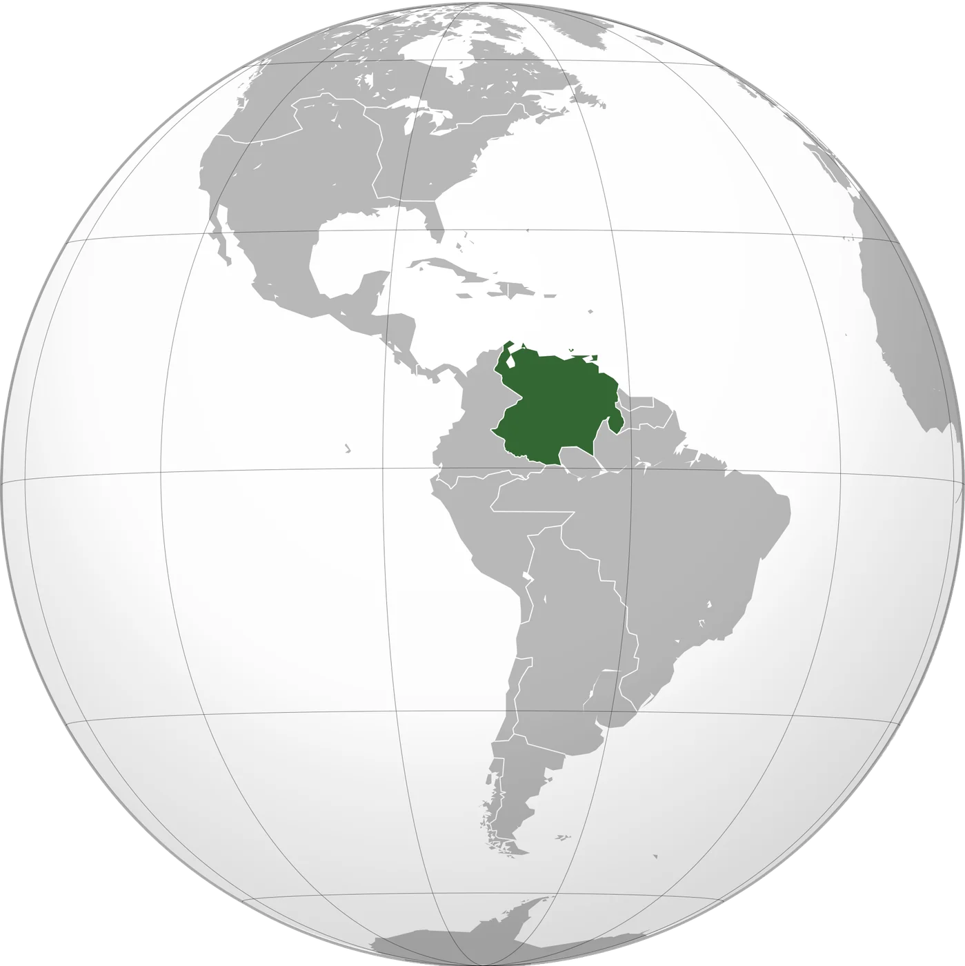
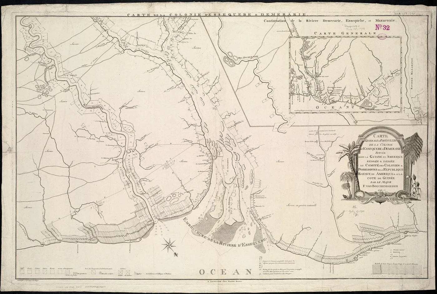
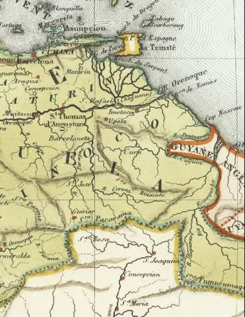
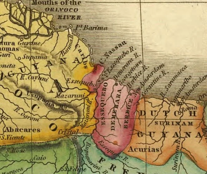
Venezuelan legal historiography emphasizes Spanish titles. A key reference is the Royal Decree of Charles III of 8 September 1777 creating the Captaincy General of Venezuela, which Venezuelan writers treat as fixing a legitimate territorial extent that included areas later contested with the British. The republican principle of uti possidetis iuris — newly independent states inherit the administrative boundaries of the colonial entities they succeed — is central to Venezuela’s argument that those Spanish-era titles should have defined the boundary with British Guiana. British and later Guyanese narratives stress effective occupation, exploration, and treaties that, in their view, established control east of lines favorable to the colony. The nineteenth century saw competing claims between the Orinoco and the Essequibo as both sides mapped, settled, and protested. A historical account from CEBRI sets out the competing colonial and republican narratives.

The 1899 Paris Award — why Venezuela rejects it
Under the 1897 Treaty of Washington, the boundary dispute went to arbitration. The tribunal issued the Paris Arbitral Award on 3 October 1899. The award gave Venezuela the mouth of the Orinoco and lands on both sides, and assigned to the United Kingdom the lands eastward toward the Essequibo — a result that left most of the contested interior on the British side. Venezuela later denounced the award as null and void. Recurring Venezuelan critiques include: lack of meaningful Venezuelan participation in the arbitral dynamics as presented in nationalist historiography; alleged political deal-making among great powers (including references to an “Anglo-Russian” arrangement involving arbitrator de Martens); insufficient examination of Spanish titles and uti possidetis; and absence of the kind of reasoned territorial analysis Venezuela considers required. Whether every critique meets modern international-law standards is debated; what matters for understanding Venezuelan policy is that the award is treated domestically as an illegitimate dispossession, not as a closed chapter. The Law Library of Congress describes the 1899 Award and Venezuela's later objections without treating the objections as settled fact.
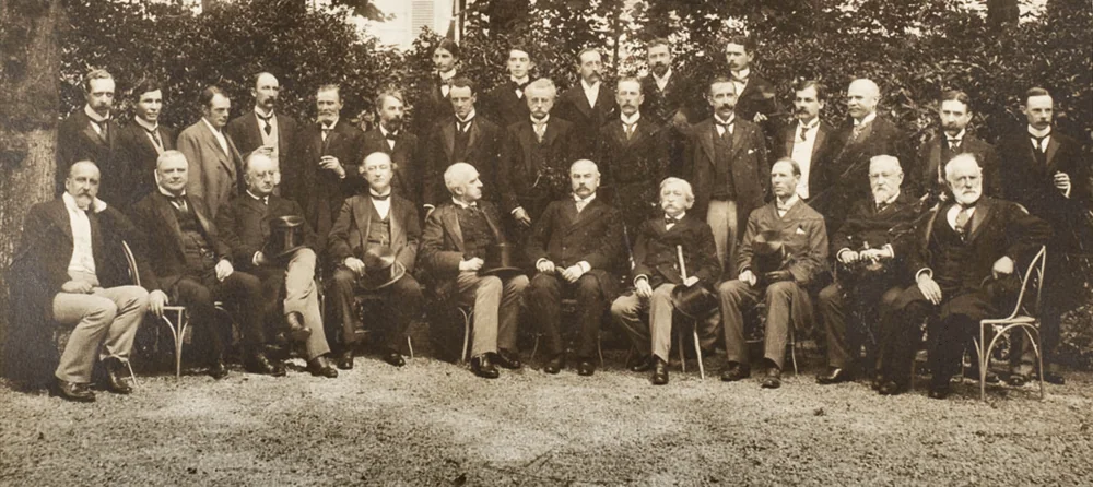

For more than half a century after 1899, the award was largely treated as the operative line in international practice. Venezuela’s formal challenge intensified in the early 1960s as British Guiana approached independence. In 1962 Venezuela informed the United Nations that it did not recognize the validity of the 1899 Award. Diplomatic talks followed with the United Kingdom and British Guiana. The political context was decolonization: a new state would inherit whatever border regime existed at independence unless a different settlement was agreed. CEBRI's historical chronology records the 1962 challenge and the diplomatic context of independence.
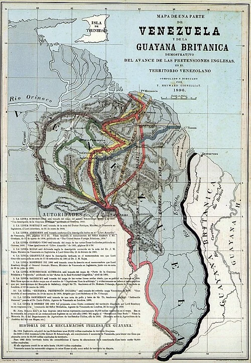

1962 protest and the road to Geneva
The 1966 Geneva Agreement
On 17 February 1966, Venezuela, the United Kingdom and British Guiana signed the Geneva Agreement to resolve the controversy over the frontier. English and Spanish texts are authoritative. When Guyana became independent on 26 May 1966, it became a party to the Agreement alongside the UK and Venezuela. The Agreement created a Mixed Commission and a pathway for means of settlement. Critically for Venezuelan diplomacy, Geneva is treated as the only fully valid legal framework still in force to seek a practical and satisfactory settlement for both sides — as opposed to treating 1899 as final. Venezuelan officials and jurists repeatedly insist that negotiations and solutions should proceed on the basis of Geneva, not on automatic confirmation of the 1899 line. Article IV mechanisms eventually allowed referral of the choice of means of settlement to the UN Secretary-General when parties could not agree. The treaty text is available in the United Nations Treaty Series; the UN Peacemaker record summarizes its settlement mechanism.

Port of Spain Protocol and later diplomacy
The 1970 Protocol of Port of Spain imposed a twelve-year moratorium on pressing the claim under certain Geneva procedures. Venezuela did not renew that moratorium in 1981. Good-offices processes under UN Secretaries-General ran for years without a final settlement. In January 2018 the Secretary-General chose the International Court of Justice as the means of settlement under the Geneva framework, and Guyana filed its application at the Court in March 2018.
ICJ proceedings since 2018
Guyana asked the Court to confirm the validity and binding effect of the 1899 Award and related boundary questions. Jurisdiction was contested. In December 2020 the Court found it had jurisdiction to hear claims concerning the validity of the 1899 Award and the definitive settlement of the land boundary, within the scope tied to the Geneva Agreement pathway. In April 2023 the Court rejected Venezuela’s preliminary objection and held it could rule on the merits within that scope. In December 2023 the Court ordered provisional measures requiring Venezuela to refrain from actions that would modify the situation in which Guyana administers and controls the disputed area. Proceedings on the merits have continued with written and oral phases; public summaries and orders are available on the ICJ website. This article does not predict the judgment. The ICJ case record links the 2020 and 2023 decisions and the later provisional-measures proceedings.

Oil, geopolitics and the 2023 referendum
Offshore hydrocarbon discoveries in waters associated with Guyana’s Atlantic facade raised the economic stakes of maritime and land delimitation narratives. Venezuela held a December 2023 consultative referendum on the Essequibo claim; official results reported overwhelming support among participants for asserting Venezuelan rights, while turnout and interpretation remain politically contested. Foreign investors in either country must separate domestic political messaging from enforceable title, insurance, and sanctions risk. For the referendum and the competing legal positions, see the Law Library of Congress FALQ.

What this means for foreigners
- Travel and business in recognized Venezuelan states (Caracas, Nueva Esparta, Zulia, etc.) are not the same as operating inside the disputed zone.
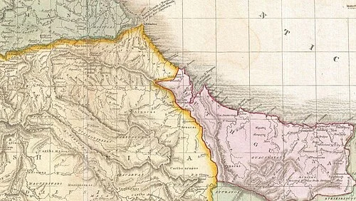
- Maps differ. Venezuelan official cartography includes the claim; Guyanese and many international maps do not.
- Contracts and security. Any project near the contested area needs specialized political-risk and legal review — far beyond a standard Caracas apartment purchase.
- Tone. For diaspora and foreign clients, Venezuela Advisor explains the historical claim and legal milestones so readers understand why the issue appears in speeches, textbooks and headlines — without turning an advisory site into a diplomatic brief.
Reading both narratives fairly
Guyana’s case emphasizes the 1899 Award, long administration, and ICJ jurisdiction under Geneva’s settlement pathway. Venezuela’s case emphasizes colonial titles, nullity of 1899, and Geneva as the framework for a practical settlement rather than automatic validation of the award. Serious readers should consult the Geneva Agreement text, ICJ judgments of 2020 and 2023, and primary diplomatic documents — not only social-media maps. For property, visas and investment inside undisputed Venezuelan territory, use the dedicated guides on RIF, banking, due diligence and visa categories. Guayana Esequiba is a sovereignty controversy; it is not a substitute checklist for buying a flat in Los Palos Grandes. Compare the historical account with the primary materials linked below.

Timeline at a glance
- 1777 — Royal Decree creates the Captaincy General of Venezuela (title cited in Venezuelan historiography).
- 1897 — Treaty of Washington submits the boundary dispute to arbitration.
- 3 October 1899 — Paris Arbitral Award draws the line Venezuela later rejects.
- 1962 — Venezuela protests the award at the United Nations.
- 17 February 1966 — Geneva Agreement signed; Guyana accedes at independence (26 May 1966).
- 1970–1982 — Port of Spain Protocol moratorium period.
- 2018 — UN Secretary-General chooses the ICJ; Guyana files its application.
- 2020 & 2023 — ICJ jurisdiction decisions; December 2023 provisional measures.
For diaspora readers
Many Venezuelans abroad grew up with the Essequibo claim as part of national geography education. Foreign partners and counsel often encounter the issue for the first time when a headline spikes. Share primary texts — Geneva 1966 and ICJ summaries — rather than only viral maps. If you invest or travel in Venezuela, keep operational focus on undisputed jurisdictions unless you have specialized political-risk coverage for the contested zone. In Spanish the claim is almost always Guayana Esequiba. English media often say Essequibo (Guyanese spelling) or “the Essequibo region.” Both refer to the same controversy. When searching court documents, use the ICJ case title Arbitral Award of 3 October 1899 (Guyana v. Venezuela). The ICJ case page and Geneva Agreement record are the useful starting points for readers abroad.

Language note for English readers
Sovereignty controversies and advisory work
Venezuela Advisor’s mandate is practical guidance for tourism, business, living and investment inside Venezuela’s administered cities and coasts. Explaining Guayana Esequiba is part of cultural and political literacy for clients who see the claim in the news. It does not change the checklist for a tourist visa, a Caracas lease, or a Margarita title search — those remain the day-to-day tools published in our visa and property series. With Venezuelan clients, recognize the claim as part of national education. With international counsel, use primary texts (Geneva 1966, ICJ orders). Avoid bar-stool maximalism and avoid dismissive “just let it go” talk that ignores identity. Precision is respect.

How to talk about it in mixed company
How each side names and organizes the territory
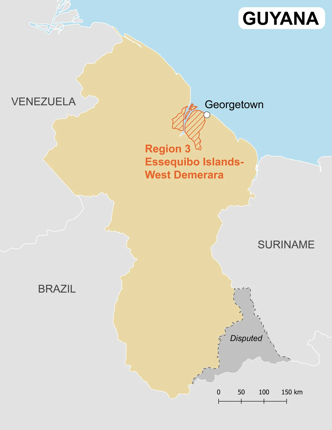
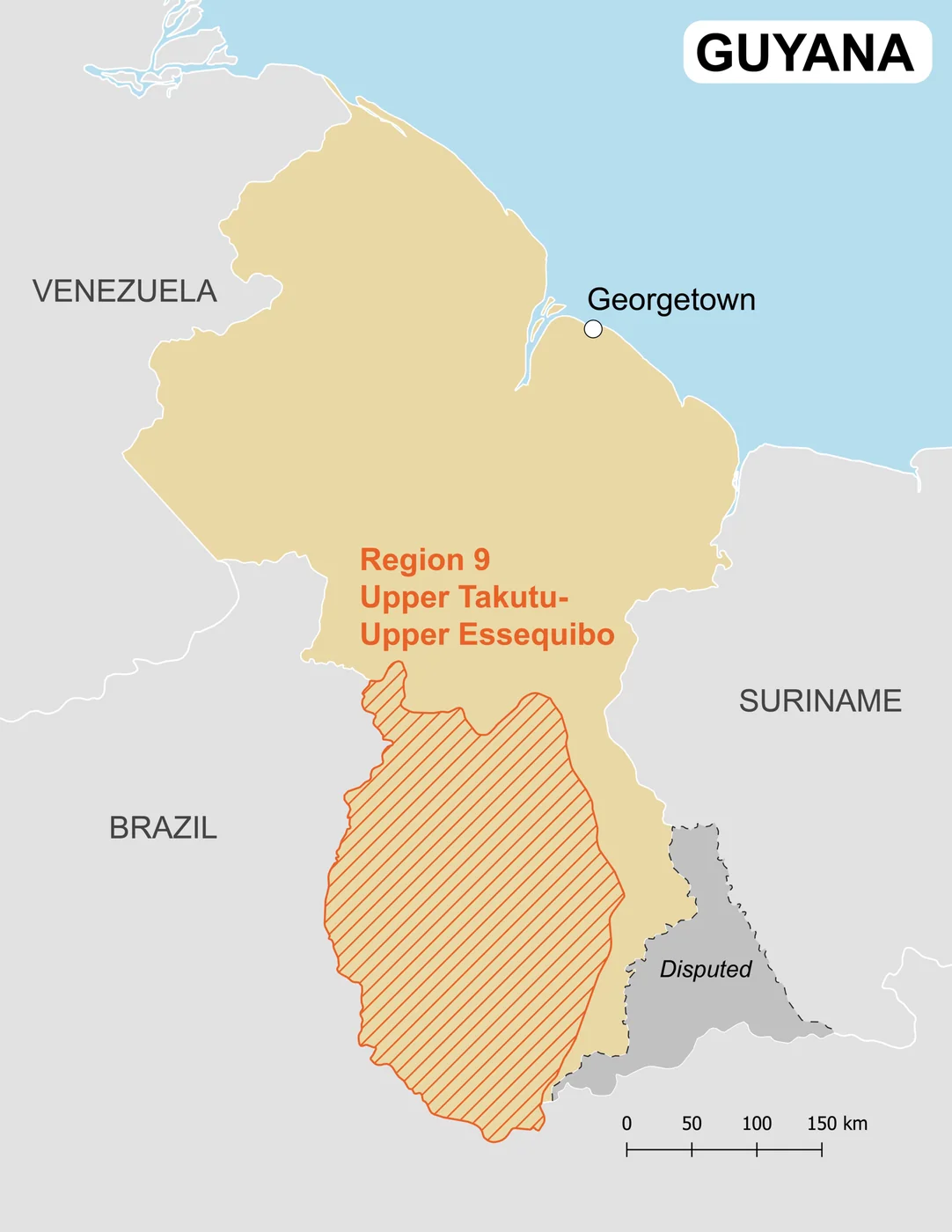
Venezuela calls the area Guayana Esequiba and treats it in national discourse and cartography as Venezuelan territory — including its presentation as a state-level claim in official Venezuelan political and educational materials. Venezuelan maps shade Guayana Esequiba as part of the country’s territorial claim west of the Essequibo (Esequibo) River line used in the dispute narrative. Guyana does not use that framing. For Guyana the same land forms an important part of its sovereign territory and is integrated into Guyana’s ordinary administrative regions (the regional organization of the Cooperative Republic of Guyana). In Guyanese and most international administrative practice, the area is governed as part of Guyana’s regional system — not as a Venezuelan state. The Law Library of Congress overview distinguishes Venezuela's naming claim from Guyana's administration.
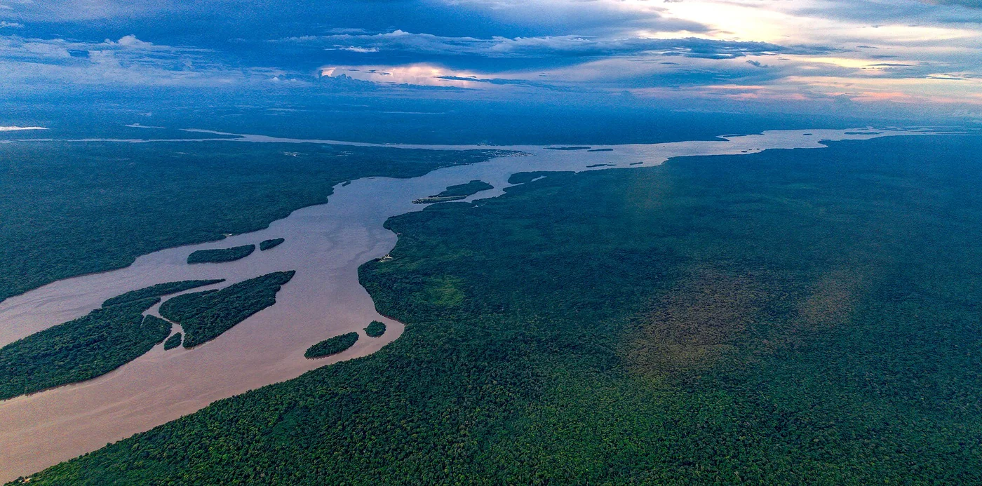

English-language sources often say Essequibo (river and region). Spanish Venezuelan usage standardizes Guayana Esequiba for the claimed zone and Esequibo for the river. This guide uses Guayana Esequiba when referring to Venezuela’s claim name, and notes Guyana’s regional administration when referring to how the territory is run on the ground today.

Venezuela: Guayana Esequiba in the national territorial framework
In Venezuelan official and educational discourse, Guayana Esequiba is not treated as a vague border strip. It is named, mapped and taught as Venezuelan territory. Political and administrative rhetoric has included presenting Guayana Esequiba within a state-level framing of the Republic — part of how Caracas communicates the claim to citizens and to the international system. Foreign readers should understand that, for Venezuela, this is a full territorial claim with state identity attached, not a minor technical delimitation. That does not by itself change who collects taxes or runs schools on the ground today. It does explain why Venezuelan maps, textbooks and speeches treat Guayana Esequiba as integral national space. The Law Library of Congress overview describes the state-level proposal as a political measure, not a change in on-the-ground administration.

Guyana: administrative regions on the ground
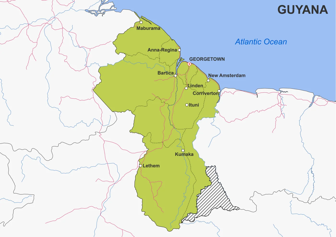
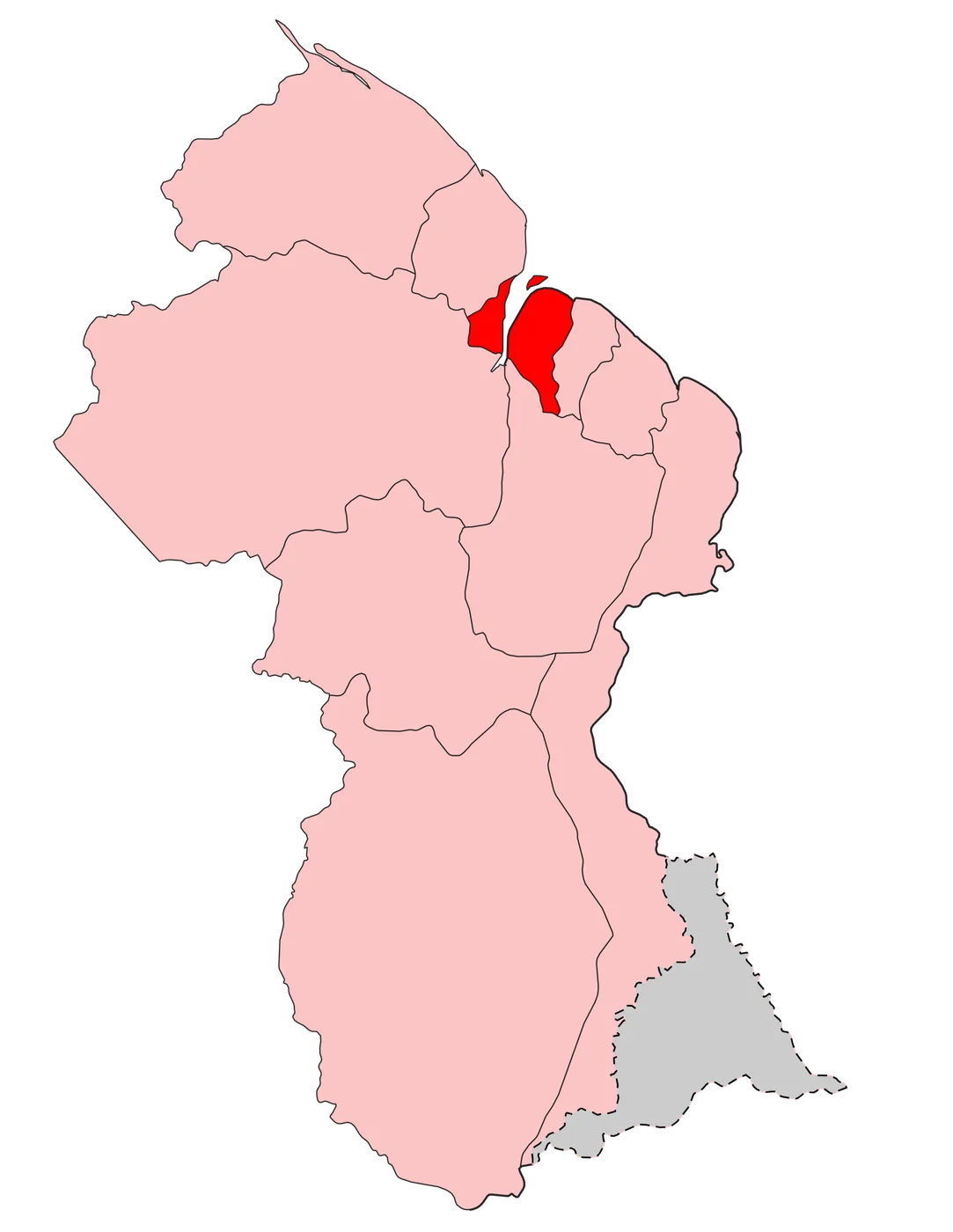
Guyana organizes its territory into administrative regions under national law. The land Venezuela calls Guayana Esequiba overlaps areas that Guyana governs through that regional system — local administration, public services and the ordinary machinery of a state that considers the area part of its sovereign territory. International maps used by most third countries and organizations typically follow the line associated with the 1899 Award for day-to-day depiction, while the legal controversy continues in the Geneva–ICJ track. The Law Library of Congress overview identifies Guyana's administration of the disputed area in its discussion of provisional measures.

For practical purposes: two legal-political stories, one geography. Venezuela’s name and state claim (Guayana Esequiba); Guyana’s regional administration and effective control narrative.

Implications for investors and travelers
- Projects and travel inside undisputed Venezuelan states (e.g. Caracas, Nueva Esparta, Zulia) are a different risk file from activity inside the disputed zone.
- Contracts, insurance and political-risk products must name the correct jurisdiction and control assumptions.
- Do not rely on social-media maps alone; use counsel and primary legal texts (Geneva 1966, ICJ orders).
Frequently asked questions
What is Guayana Esequiba?
Guayana Esequiba — the territory between the Essequibo River and Venezuela’s eastern claim line — about 159,500 km² — which Venezuela claims and Guyana administers as part of its state.

Why does Venezuela reject the 1899 Award?
Venezuelan doctrine treats the Paris Arbitral Award as null, citing defects in process, alleged great-power deal-making, and failure to respect Spanish titles and uti possidetis.

What is the 1966 Geneva Agreement?
The treaty signed by Venezuela, the UK and British Guiana (Guyana as successor) to resolve the frontier controversy; Venezuela treats it as the valid framework for a practical settlement. The UNTS treaty text and UN Peacemaker entry are the primary places to read the agreement itself.

Is the dispute at the ICJ?
Yes. Guyana applied in 2018; the Court upheld jurisdiction on key points (2020, 2023) and issued provisional measures in December 2023. The ICJ case page is the primary source for the Court's jurisdictional and provisional-measures record.

Does this affect buying property in Caracas?
Not as a title defect on a Caracas apartment. It is a separate sovereignty issue. Standard due diligence still applies to any Venezuelan purchase.

What was the 2023 referendum?
A Venezuelan consultative vote on asserting rights over the Essequibo; official tallies showed strong support among participants, with political debate over turnout and effects.

How much of Guyana is claimed?
Common descriptions refer to roughly two-thirds to three-quarters of Guyana’s territory west of the Essequibo — always check precise map definitions. For the area figure and its limits, compare the Law Library of Congress overview with the maps linked in the references.

Where can I read primary sources?
Geneva Agreement 1966, ICJ case pages on the 1899 Award (Guyana v. Venezuela), and historical materials on the 1777 Captaincy General and the 1899 Award. The ICJ case page, Geneva Agreement text and Law Library of Congress resource list provide the primary reading path.

Questions or comments?
Leave us your message through the contact form — we will be glad to share our experience and help you with the next steps of your plans in Venezuela.
References
- International Court of Justice, “Arbitral Award of 3 October 1899 (Guyana v. Venezuela), Case 171.” Current case record, judgments, orders and hearing materials.
- United Nations Treaty Series, Geneva Agreement of 17 February 1966. Authoritative English treaty text.
- United Nations Peacemaker, “Agreement to Resolve the Controversy over the Frontier between Venezuela and British Guiana.” Parties and settlement mechanism.
- Library of Congress Law Library, “FALQs: Guyana-Venezuela Territorial Dispute.” Legal-history and referendum overview.
- CEBRI, “Notes on the History of the Venezuela/Guyana Boundary Dispute.” Historical chronology and diplomatic context.
This guide is general orientation, not a guarantee of eligibility, safety or investment returns. For the scope of the October 2026 priority update, read our editorial policy.